Recent Imagery: Find Dry Trail Major Update – Hosted by
Scout trail conditions with Recent Imagery

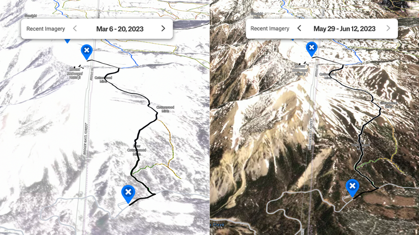
The onX Backcountry Hiking Trails app recently launched an exciting new feature - Recent Imagery. This major update allows users to see up-to-date satellite images of trail conditions, ensuring you can plan your next adventure with confidence. Whether you're looking to hit the slopes, hit the trail, or take a leisurely bike ride, Recent Imagery has got you covered.
From May 7th through May 31st, onX is highlighting this powerful new tool. Now, you can easily scope out if that high-altitude path is still buried under snow or if the lower elevations are clear and dry. No more guessing games - just tap into the latest aerial shots to make informed decisions about your route. This event is a game-changer for outdoor enthusiasts who want to maximize their time on the trail and minimize surprises.
Don't let unpredictable mountain weather catch you off guard. Explore the onX Backcountry Hiking Trails app during this limited-time Recent Imagery event and never set out unprepared again. With accurate, up-to-the-minute trail conditions at your fingertips, you'll be able to plan the perfect day in nature, whether you're skiing fresh powder or hiking under the spring sun. Get out there and enjoy the great outdoors with confidence!


