KickTheMap

KickTheMap

3D Scanner

⭐️4.3 / 5
Rating
🙌4
Ratings
📼6 scs
Content
📦~ in 2 weeks
Updates frequency
🗣❌ unsupported
Your locale

All Versions of KickTheMap

2.3.7

June 21, 2024

- Insee code

2.3.6

June 5, 2024

- Added German language - Improved warning system - Added job restart

2.3.5

April 14, 2024

- Improvement of the translation system

2.3.4

April 9, 2024

- disable compass feature for some devices - fix gcps name

2.3.3

April 2, 2024

- bug fixes

2.3.2

April 1, 2024

- Improved list input - Added customizable forms - Added limitations - Bug fixes
More

2.3.1

March 4, 2024

- Autofocus mode - Bug fixes

2.3.0

January 22, 2024

- Bug fixes

2.2.9

January 9, 2024

- Improvement of the NTRIP server connection - Improvement of the mounting point management - Bug fixes
More

2.2.8

November 1, 2023

- Added brand new BLE communication for the HaX RTK - Added new Configuration page design - Added in-app NTRIP network management - Improved timings on pictures's geotags - Added disconnection feature for the HaX RTK - Fixed few bugs
More

Price History of KickTheMap

Description of KickTheMap

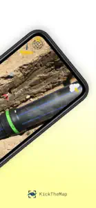
This is the perfect tool for utility mapping, volumes calculation, road mapping and infrastructure modelling (bridges, tunnels, retaining walls..). No prior knowledge required! Just walk around your site and the app works by itself, taking pictures all along the way thanks to an advanced Augmented Reality engine. 3D models are delivered within 24 hours on your personal desktop platform, allowing you to visualise, measure, digitise and export your data. Possibility to scale or georeference your model within the app with simple and intuitive features. App Features: - Picture auto-trigger based on user's motion - 3D model delivered within 24h - Up to 2000 pictures/job - Lightweight pictures for fast upload - Scale your model with a known distance - Georeference your model with on known points - Accuracy of 3 cm (1.2 in) in XYZ - In-app warnings - Unlimited number of jobs - Output quality checks - Offline mode in case of no internet coverage - Pictures counter Platform features: - High-quality visualisation - Fast rendering of millions of points - Distance, height, area - Easy digitisation with points and polylines - Objects attributes to export - Multiple point clouds display - Export objects in DXF, CSV or JSON - Export point clouds in LAS Trial version is limited to 5 projects of 150 pictures max.
Show less

KickTheMap: FAQ

Is KickTheMap software compatible with iPad devices?

Yes, KickTheMap is compatible with the iPad.
The KickTheMap app was launched by KickTheMap Sarl.
The minimum iOS requirement for the app is 14.0 or higher.
Users love KickTheMap, as evidenced by its outstanding rating of 4.3 out of 5.
The App Genre Of Kickthemap Is Utilities.
The latest version of KickTheMap is 2.3.7.
KickTheMap’s latest update was rolled out on June 28, 2024.
The app was launched on February 6, 2023.
Family-friendly content, no mature themes or violence.
The KickTheMap app is now available in English, French, German.
Unfortunately, KickTheMap is not on Apple Arcade.
Unfortunately, in-app purchases are not available within KickTheMap.
Unfortunately, KickTheMap is not optimized for use with Apple Vision Pro.

Screenshots of KickTheMap

iphone
ipad

Alternatives to KickTheMap

Reviews of KickTheMap

  • Great photogrammetry app!

    Awesome app for photogrammetry / 3D modeling! Easy to use, fast and lots of features. Free version is excellent for smaller projects. Best app of its kind I have found so far.