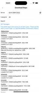
QuoVadis X Mobile
Your journey. Advanced.
About QuoVadis X Mobile
- Released
- Updated
- iOS Version
- Age Rating
- Size
- Devices
- Languages
Features
Developer of QuoVadis X Mobile
What's New in QuoVadis X Mobile
1.1.29
November 13, 2024
Updated screenshots
Subscription plans
Email Support Subscription
Receive personal email support
Alternatives to QuoVadis X Mobile
FAQ
Does QuoVadis X Mobile work on iPad devices?
Yes, QuoVadis X Mobile has support for iPad devices.
Who launched the app?
QuoVadis Software GmbH released the QuoVadis X Mobile app.
What is the minimum iOS version supported by QuoVadis X Mobile?
The minimum iOS requirement for the app is 12 or higher.
How do users rate the app?
Currently, the QuoVadis X Mobile app has no user ratings.
What’s the app category of QuoVadis X Mobile?
The Main Genre Of The Quovadis X Mobile App Is Navigation.
What’s the latest version of the QuoVadis X Mobile app?
The latest version of QuoVadis X Mobile is 1.1.29.
When was the most recent QuoVadis X Mobile update made available?
The last update for QuoVadis X Mobile was on December 11, 2024.
Do you know when QuoVadis X Mobile was first made available?
QuoVadis X Mobile was first released on February 6, 2023.
What is the age rating of QuoVadis X Mobile?
This app is appropriate for all ages, with no offensive or inappropriate content.
What are the languages supported by QuoVadis X Mobile?
QuoVadis X Mobile is available in English, German.
Does Apple Arcade offer QuoVadis X Mobile as part of its collection?
No, QuoVadis X Mobile is not featured on Apple Arcade.
Can I make in-app purchases within QuoVadis X Mobile?
Yes, you can make in-app purchases to unlock additional features in QuoVadis X Mobile.
Can I use QuoVadis X Mobile with Apple Vision Pro?
No, you cannot use QuoVadis X Mobile with Apple Vision Pro.
Does QuoVadis X Mobile use ad-based monetization?
No, QuoVadis X Mobile does not use ad-based monetization.


