Live Reviews:
SkyPath Pro

SkyPath Pro

Turbulence alert system

⭐️4.8 / 5
Rating
🙌6
Ratings
📼0 sc
Content
📦~ in 2 months
Updates frequency
🗣❌ unsupported
Your locale

All Versions of SkyPath Pro

5.0.5

June 20, 2024

SkyPath Nowcast Layer - Unveiling a new groundbreaking, innovative prediction layer. SkyPath Nowcast uses SkyPath home grown machine learning algorithm that utilizes atmospheric conditions and real turbulence reports to produce 6 hours of high resolution, global, predicted turbulence conditions. Official PIREP Submission - Contributing to the industry’s safety - SkyPath is approved by the FAA to submit official PIREPs from the app’s interface directly to the NWS PIREP system. Use the intuitive radar view and help other pilots mitigate the turbulence trouble. Embedded Weather Layers - To increase pilots’ situational awareness and further increase safety on board, SkyPath version 5.0 is introducing multiple new weather layers, that can be easily controlled from the Layers menu, and can be displayed simultaneously for a complete and comprehensive map display. Apple Watch - Noisy cockpit? Not a problem at all. Connect your Apple Watch to SkyPath and receive all the notifications to your Watch. Find the connection guide and settings under Settings > Notifications > Apple Watch.
More

5.0.2

April 1, 2024

SkyPath Nowcast Layer - Unveiling a new groundbreaking, innovative prediction layer. SkyPath Nowcast uses SkyPath home grown machine learning algorithm that utilizes atmospheric conditions and real turbulence reports to produce 6 hours of high resolution, global, predicted turbulence conditions. Official PIREP Submission - Contributing to the industry’s safety - SkyPath is approved by the FAA to submit official PIREPs from the app’s interface directly to the NWS PIREP system. Use the intuitive radar view and help other pilots mitigate the turbulence trouble. Embedded Weather Layers - To increase pilots’ situational awareness and further increase safety on board, SkyPath version 5.0 is introducing multiple new weather layers, that can be easily controlled from the Layers menu, and can be displayed simultaneously for a complete and comprehensive map display. Apple Watch - Noisy cockpit? Not a problem at all. Connect your Apple Watch to SkyPath and receive all the notifications to your Watch. Find the connection guide and settings under Settings > Notifications > Apple Watch.
More

4.3

May 10, 2023

• Product walkthrough within the app - We made the onboarding experience better than ever, with a product walkthrough tour within the application. New users will see it right away. If you would like to learn more about how to operate SkyPath, go to the setting and take the tour. • Calculated pressure altitude display - We have added the ability to calculate and display your pressure altitude. SkyPath uses the iPad’s GPS and the atmospheric conditions at the flight’s current location. In addition, you will also find the altitude slider much more informative and easy to use as your altitude and the search block are conveniently displayed there. • Ride conditions - Forecasted ride conditions based on the current turbulence reports along the route. The popup will be shown after starting a flight. The ride conditions are updated throughout the flight and visible via the flight status box. • Enhanced background notifications and Split view - From now on, you don’t need to open SkyPath to the foreground to view the content of the background notifications. You can use the iPad’s haptic touch to extend them and receive more information about them. SkyPath also supports split view mode for simultaneous work with other applications. • Map enhancements - Dark mode logic is upgraded and is now linked to your iPad’s settings automatically. You can change it manually. Map now supports Multi-Select menu when there is more than one entity around your finger. Map information logic was upgraded to ensure a smoother experience when zooming in and out, also when offline. Vertical View will now follow your flight direction automatically.
More

4.2.5

December 29, 2022

Map layers were updated

4.2.4

November 27, 2022

Map layers were updated

4.2.3

September 22, 2022

• Fully automated set angle - After starting a flight, the angle is set automatically. There is no need to recalibrate anymore, as it will sense when to pause and when to restart the turbulence recording. • Globe view and Smart polygon layer - We have added a smart polygon layer to show a zoom-out overview of turbulence reports in a certain area. It will change to the known granular reports when zooming in. The vertical view has improved UX and tapping on smooth reports is now enabled as well. • Corridor support - The turbulence information will be focused around the route (250 miles from each side). To view other areas, move the viewport on the map and the information will be fetched. There is now an option to download data only along the route - under Settings>Map information with the ability to set the width of the corridor. • Airport information now includes ATIS. • After flight analytics and battery enhancements - A flight summary popup following a flight. SkyPath will also remove the previous flight and turn off the location services automatically after landing to conserve battery.
More

4.2.2

September 16, 2022

• Fully automated set angle - After starting a flight, the angle is set automatically. There is no need to recalibrate anymore, as it will sense when to pause and when to restart the turbulence recording. • Globe view and Smart polygon layer - We have added a smart polygon layer to show a zoom-out overview of turbulence reports in a certain area. It will change to the known granular reports when zooming in. The vertical view has improved UX and tapping on smooth reports is now enabled as well. • Corridor support - The turbulence information will be focused around the route (250 miles from each side). To view other areas, move the viewport on the map and the information will be fetched. There is now an option to download data only along the route - under Settings>Map information with the ability to set the width of the corridor. • Airport information now includes ATIS. • After flight analytics and battery enhancements - A flight summary popup following a flight. SkyPath will also remove the previous flight and turn off the location services automatically after landing to conserve battery.
More

4.2.1

September 8, 2022

• Fully automated set angle - After starting a flight, the angle is set automatically. There is no need to recalibrate anymore, as it will sense when to pause and when to restart the turbulence recording. • Globe view and Smart polygon layer - We have added a smart polygon layer to show a zoom-out overview of turbulence reports in a certain area. It will change to the known granular reports when zooming in. The vertical view has improved UX and tapping on smooth reports is now enabled as well. • Corridor support - The turbulence information will be focused around the route (250 miles from each side). To view other areas, move the viewport on the map and the information will be fetched. There is now an option to download data only along the route - under Settings>Map information with the ability to set the width of the corridor. • Airport information now includes ATIS. • After flight analytics and battery enhancements - A flight summary popup following a flight. SkyPath will also remove the previous flight and turn off the location services automatically after landing to conserve battery.
More

4.2

August 3, 2022

• Fully automated set angle - After starting a flight, the angle is set automatically. There is no need to recalibrate anymore, as it will sense when to pause and when to restart the turbulence recording. • Globe view and Smart polygon layer - We have added a smart polygon layer to show a zoom-out overview of turbulence reports in a certain area. It will change to the known granular reports when zooming in. The vertical view has improved UX and tapping on smooth reports is now enabled as well. • Corridor support - The turbulence information will be focused around the route (250 miles from each side). To view other areas, move the viewport on the map and the information will be fetched. There is now an option to download data only along the route - under Settings>Map information with the ability to set the width of the corridor. • Airport information now includes ATIS. • After flight analytics and battery enhancements - A flight summary popup following a flight. SkyPath will also remove the previous flight and turn off the location services automatically after landing to conserve battery.
More

4.0.2

May 24, 2022

What's new in v4.0.2 - Fixed an issue that affected map layers and ownership position. What's new in v4.0 - * Vertical view is now available - A comprehensive vertical view tool for a complete turbulence situational awareness. Introducing a tactical vertical view within the turbulence notifications, under more info. At any time open the vertical view from the route box button to see the entire vertical view of the entire route. * Braking action reports - Receive real time braking action reports from other pilots. Either report it manually through the PIREP menu or get reminded after landing only if the weather conditions are not great. * Airport Information - You can now tap on any airport and get useful information on the weather status, braking action and arrival delays. A notification before landing at your destination will provide this information as well automatically. * Route upgrades - Starting and ending a flight is now easier than ever. Upgraded flight plan integration, switching A/C types, automatic and enhanced set angle only after you start, and more. * New pireps and pirep data on tap - Report mountain waves and include wind fluctuations for windshear to avoid over speeding. You can now also tap on any PIREP and get additional information such as the reported time and relative altitude where relevant
More

Price History of SkyPath Pro

Description of SkyPath Pro

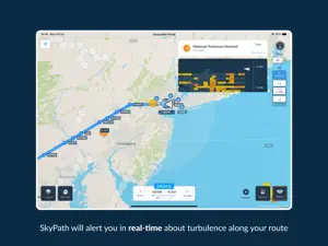
SkyPath's goal is delivery of accurate real-time turbulence data, based on crowdsourcing. SkyPath provides real-time data combined with aviation expertise enabling the company to offer an optimal solution for turbulence. The turbulence problem costs the airline hundreds of millions of dollars due to crew and passenger injuries, operational delays, and unscheduled aircraft maintenance. For over 30 years the aviation community is trying to come to grips with CAT (Clear Air Turbulence). The available data is cumbersome, elusive and unreliable in telling the pilots what to do. How it works SkyPath is a Crowd Sourcing, network based system, using accelerometer and GPS data from tablets and other mobile devices - transmitting real-time data from the air - to a server and back to users. Safety of flight is a major focus - SkyPath operates in the background and will alert the pilots ahead of time-without compromising safety of flight. Airline pilots are equipped with Electronic Flight Bags (EFB) tablets with which they perform many tasks during flights. By using the SkyPath app on their iPads, they become part of the crowdsourcing solution. This enables both pilots and planners to utilize real time access to turbulence conditions. Real Time An automatic real-time turbulence “sense and display” system Safety First Allows pilots to choose an optimal route keeping passengers safe Crowdsourced Based on sharing crowdsourced information detected in real time Plug n Play SkyPath could be installed easily, quickly and for no extra set up cost. Using SkyPath: Reduce severe turbulence inspections: With objective, real-time reports, maintenance can be notified of the exact "G" tolerance incursions and apply the precise maintenance thus saving unnecessary inspections. Flying through turbulent areas may result with the aircraft overspeeding the Mach limit (MMO). SkyPath allows the pilots to prepare and reduce speed accordingly. Reduce on-board injuries: Crew and passenger injuries create tangible costs and issues of concern. "Crowd Sourcing" wisdom increases pilot and dispatch awareness and confidence in efficiently navigating turbulence. Reduce enroute fuel consumption and preflight reserve fueling: Better information leads to better decisions in critical areas where safety is balanced with efficiency. SkyPath increases the operations department’s trust and confidence in route projections of turbulence hazards as well as allows pilots to safely navigate during the occurrence of rapidly emerging turbulence situations. Significant costs may be avoided in more efficient decisions in loading contingency fuel (for weather avoidance enroute). Improve forecast guidance for planning: The turbulence feedback loop is instantaneous. More flyable airspace opens up more efficiency for flight planning.
Show less

SkyPath Pro: FAQ

Does SkyPath Pro work on iPad devices?

Yes, SkyPath Pro can support iPad devices.
The SkyPath Pro app was made by SKYPATH LTD.
SkyPath Pro currently supports iOS 14.0 or later.
Users are raving about SkyPath Pro, which has an exceptional rating of 4.8 out of 5.
Skypath Pro Relates To The Weather App Genre.
The newest version of SkyPath Pro is 5.0.5.
SkyPath Pro updated its app on July 2, 2024.
The release date of the app was February 6, 2023.
This app is rated for ages 4 and up, and contains only family-friendly content.
The following list of languages is supported by the SkyPath Pro app: English.
No, SkyPath Pro is not on Apple Arcade.
No, SkyPath Pro does not support in-app purchases.
No, SkyPath Pro does not provide support for Apple Vision Pro.

Screenshot of SkyPath Pro

ipad

Alternatives to SkyPath Pro

Reviews of SkyPath Pro

  • Amazing App, game changer

    Great App, changing the way we fly