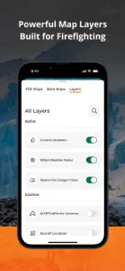
IGNIS | Wildfire Operations
GPS Mapping for Wildland Fire
Details about IGNIS | Wildfire Operations
- Released
- Updated
- iOS Version
- Age Rating
- Size
- Devices
- Languages
Features
Developer of IGNIS | Wildfire Operations
- Versions+1
- Price History
- Description
- FAQ
Version History of IGNIS | Wildfire Operations
1.7
September 23, 2024
- Fixed: Issue with teams appearing in the team switcher to which the user doesn't belong - Fixed: Incorrect team name showing in the welcome dialog after joining a team - Fixed: Display issues by removing the map location accuracy ring - General code enhancements, cleanup and maintenance
More1.6
September 9, 2024
- Fixed: Recorded lines not showing when offline - Fixed: Inability to delete personal PDF maps that have not been downloaded - Fixed: Organization PDF maps disappearing from the list after removing them from a device - Fixed: PDF map download error handling - Fixed: Incident details sheet overlapping hamburger menu - General code cleanup and maintenance
More1.5
August 19, 2024
- Fixed: incident details readability in dark mode - Fixed: display issues with incident estimated acres - Fixed: team members screen not showing all members - Fixed: close buttons missing on the line and polygon type sheets - General code cleanup and maintenance
More1.4
August 12, 2024
- New: added estimated acres to incident details - New: updated incident details layout - New: you can now open PDF maps using "Open in Ignis" - New: updated app loading quotes - Fixed: user map features not showing in global searches - Fixed: performance of viewing incident details - Fixed: issue with decimals not showing for acres in incident details - Fixed: crashes related to clearing map caches - Fixed: layout issues with larger system fonts - General code cleanup and maintenance.
More1.3
July 23, 2024
- New: you can now pan the map while recording a track - New: tap gesture can now be used to complete a polygon when drawing - New: track recording now includes time elapsed - New: you can now switch between different teams in the teams dashboard - Fixed: The map search results would not scroll properly when the keyboard was showing - Fixed: The nav bar now properly hides when using the map search - Fixed: team invitations would not work if the app was not already in the background - Fixed: several bugs leading to crashes
More1.2
July 8, 2024
- New: Added an option to reset map layers to default - Fixed: imported PDF maps were displaying incorrectly in the map layers view - Fixed: User created lines and polygons were not visible at some map zoom levels - Fixed: Map search would not return incidents - Fixed: Sometimes the map would load the wrong location on app start - Fixed: Crash opening hamburger menu when your first name on your profile was empty. - Fixed: After joining a new team, shared map data would not be visible until the app was restarted
More1.1
July 1, 2024
- New: Wifi-only iPads are now supported :) - Fixed: Occasionally, the map view would not restore its camera position correctly. - New: User created map points now support clustering.
More1.0
June 24, 2024
Price History of IGNIS | Wildfire Operations
Description of IGNIS | Wildfire Operations
IGNIS | Wildfire Operations: FAQ
Is IGNIS | Wildfire Operations iPad-friendly?
Yes, the IGNIS | Wildfire Operations app is compatible with iPads.
Who is behind the development of the IGNIS | Wildfire Operations app?
The app was developed by Ignis Technologies, Inc.
What iOS version is needed to run the IGNIS | Wildfire Operations app?
The app needs iOS 17.0 or later to function properly.
What is the current app rating?
IGNIS | Wildfire Operations has an exceptional rating of 5 out of 5, which is a testament to its quality.
What is the main genre of the IGNIS | Wildfire Operations app?
Navigation Is The Primary Genre Of The Ignis | Wildfire Operations App.
What IGNIS | Wildfire Operations application version is the current one?
1.7 is the most recent version of the IGNIS | Wildfire Operations app.
When was the last update for IGNIS | Wildfire Operations released?
IGNIS | Wildfire Operations’s most recent update was on September 29, 2024.
When was IGNIS | Wildfire Operations introduced to the market?
The app first launched on July 6, 2024.
What age rating is assigned to IGNIS | Wildfire Operations?
The IGNIS | Wildfire Operations app has a content advisory rating of 12+.
Which languages does IGNIS | Wildfire Operations support?
IGNIS | Wildfire Operations currently features the following languages: English.
Does IGNIS | Wildfire Operations belong to Apple Arcade's curated library?
Unfortunately, IGNIS | Wildfire Operations is not on Apple Arcade.
Are in-app purchases part of IGNIS | Wildfire Operations?
Unfortunately, in-app purchases are not part of IGNIS | Wildfire Operations.
Is IGNIS | Wildfire Operations tailored for Apple Vision Pro compatibility?
Unfortunately, IGNIS | Wildfire Operations is not tailored for compatibility with Apple Vision Pro.
Can I expect ads while using IGNIS | Wildfire Operations?
No, you can not expect ads while using IGNIS | Wildfire Operations.


