Garmin Pilot

Garmin Pilot

Plan. File. Fly. Log.

Details about Garmin Pilot

  • Released
  • Updated
  • iOS Version
  • Age Rating
  • Size
  • Devices
  • Languages
  • December 23, 2009
  • September 28, 2024
  • 17.4+
  • 4+
  • 368.39MB
  • iPhone, iPad
  • English

Developer of Garmin Pilot

🙌3.5K
Ratings
🗣❌ unsupported
Your locale
🖼️Download
Icons↘︎

Version History of Garmin Pilot

24.9.0

September 23, 2024

- Continued Database Concierge improvements including cloud syncing of data and flight plan transfer with waypoints to the GNX 375 - Resolved the intermittent crash when using NRST (Nearest) - Corrected the METAR station model wind barb display when flying in Track-Up mode - Restored the ability for user waypoints to be used as a departure and destination for flight planning - Improved SiriusXM radio stations text colors when using light mode - Fixed the intermittent crash when validating manual European routes using Autorouter

More

24.8.2

September 9, 2024

Resolves map zooming issues for some users

24.8.1

August 21, 2024

Resolved an issue with missing airspaces in Turkey

24.8.0

August 19, 2024

- Resolved intermittent issues with flight plan transfer - Enhanced the distance measuring tool to transition to measure in feet at 2 NM and refined data labels - Improved Database Concierge sync frequency - Fixed the issue with Enroute Safe Altitude (ESA) display in the navlog - Resolved random issue with swiping between charts in binders

More

24.7.1

August 4, 2024

- Airspace / Airport Map Enhancements - Corrected issue with distance and fuel not updating properly when switching between saved trips - Enhanced flight plan transfer capability to include all runway transitions

More

24.7.0

July 29, 2024

- Airspace / Airport Map Enhancements - Corrected issue with distance and fuel not updating properly when switching between saved trips - Enhanced flight plan transfer capability to include all runway transitions

More

24.6.1

June 25, 2024

Resolves the stability issue with FIS-B TFRs

24.6.0

June 17, 2024

- Improved best wind runway selection for airports with parallel runway - Continued enhancements to DBC including improved logging - Resolved an issue with display of airspace from the radial menu - Fixed intermittent crash when importing KML files - For users with an Australian Standard license, IFR Flight Plan filing is now available. In Trip Planning, select Global IFR Filing Services, which populates IFR as the flight rules. File as usual.

More

24.5.0

May 21, 2024

- Resolves the Open Street Map crashing issue - Database Concierge enhancement to improve the download status - Restored audio capability for repeated timer alerts - Enhancements to waypoints, including the fix for importing from a CSV files - Restored the display of NOTAMs on the map from the Airport page on iPhone - GDL 60 Aircraft Dashboard improvements, including resizing of images and filtering of aircraft

More

24.4.2

May 1, 2024

Resolves the issue with missing wind data for flight planning

Garmin Pilot In-App Purchases History

$74.99

Canada Premium

• Color-coded terrain awareness display • Terrain and obstacles alerts • Graphical icing display • Synthetic Vision • Geo-referenced FliteCharts® terminal procedures and SafeTaxi® airport diagrams. • View geo-referenced Jeppesen terminal charts

More

$74.99

Latin American Premium Upgrade

• Color-coded terrain awareness display with alerting • Synthetic Vision • Geo-referenced SafeTaxi® airport diagrams for Brazil • View geo-referenced Jeppesen terminal charts (requires Jeppesen Subscription)

More

$74.99

Europe Premium Upgrade

• IFR flight plan filing with autorouting • Color-coded terrain awareness display • Terrain and obstacles alerts • Synthetic Vision • Geo-referenced FliteCharts® terminal procedures and SafeTaxi®

More

$99.99

U.S. Premium Upgrade

• Color-coded terrain awareness display • Terrain and obstacles alerts • Graphical icing display • Synthetic Vision • Geo-referenced FliteCharts® terminal procedures and SafeTaxi®. • View geo-referenced Jeppesen terminal charts

More

$109.99

Europe Standard

• Navigation data with dynamic maps. • Radar and satellite imagery and lightning • METARs, TAFs, AIRMETs, SIGMETs, NOTAMs, PIREPs and winds aloft • File, amend and close VFR flight plans • Moving map display • Pilot logbook

More

$109.99

U.S. Standard

• Navigation data with dynamic maps. • Radar and satellite imagery and lightning strike overlay • METARs, TAFs, AIRMETs, SIGMETs, NOTAMs, PIREPs, TFRs and winds aloft • File, amend and close flight plans

More

$109.99

Canada Standard

• Navigation data with dynamic maps • Radar and satellite imagery and lightning strike overlay • METARs, TAFs, AIRMETs, SIGMETs, NOTAMs, PIREPs and winds aloft • File, amend and close flight plans

More

$109.99

Latin American Standard

• Navigation data with dynamic maps • Satellite imagery and lightning strike overlay • METARs, TAFs, AIRMETs, SIGMETs, NOTAMs, PIREPs and winds aloft • File, amend and close VFR flight plans • Moving map display with en-route charts for Brazil

More

$109.99

Pilot Asia Standard

• Navigation data with dynamic maps. • Satellite imagery and lightning strikes • METARs, TAFs, AIRMETs, SIGMETs, NOTAMs, PIREPs and winds aloft • File, amend and close VFR flight plans • Moving map display

More

$109.99

Africa Standard

• Navigation data with dynamic maps • Satellite imagery and lightning strikes • METARs, TAFs, AIRMETs, SIGMETs, NOTAMs, PIREPs and winds aloft • File, amend and close VFR flight plans. • Moving map display • Pilot logbook

More

$599.99

Worldwide Premium

• Navigation data with dynamic maps • Radar imagery for the U.S., Canada, Australia and Europe • METARs, TAFs, AIRMETs, SIGMETs, NOTAMs, PIREPs and winds aloft • File, amend and close VFR flight plans worldwide and IFR flight plans in the U.S. and Europe

More

Price History of Garmin Pilot

Description of Garmin Pilot

*30 Days Free Trial on initial download!* Plan. File. Fly. Log. Garmin Pilot is the most comprehensive suite of tools for the iPad designed specifically for general aviation and corporate pilots. Flight planning, charts, interactive maps, weather briefing resources and navigation capabilities; it’s all included. The app’s intuitive interface mirrors those on the newest Garmin touchscreen avionics so you can go seamlessly from preflight to inflight. Plan Garmin Pilot’s powerful capabilities start with pre-flight planning, providing pilots with the most comprehensive aviation weather information to make better-informed flight decisions. Pilots can check NEXRAD radar, visible and infrared cloud imagery, METARs, TAFs, AIRMETs, SIGMETs, PIREPs, NOTAMs, winds and temperature aloft, TFRs and lightning data. With Garmin Pilot, data can be displayed over Garmin’s interactive maps that support track-up navigation, VFR sectional or an IFR low or high en-route chart to visualize the weather for your route. Add text-based weather widgets and use the exclusive NavTrack feature to view weather along the planned route. File With Garmin Pilot, users can easily enter a flight plan and interactively edit it on the map. Pre-loaded forms make it quick to save and reuse data for frequently flown routes. And when the flight plan is ready, Garmin Pilot makes it simple to file, amend or close the flight plan via Leidos Flight Service or DUATS. Fly Garmin Pilot provides full en-route navigation capability on its moving map. Pilots can also navigate with Garmin’s patented panel, a GPS-driven instrument pack with a graphical HSI directional display and indicators for groundspeed, altitude and vertical speed. After takeoff, pilots can continue to view real-time weather in the U.S. and traffic information by wirelessly connecting to Garmin’s GDL 50 series portable ADS-B Receiver (sold separately). Log Garmin Pilot includes a comprehensive electronic logbook that syncs with flyGarmin. The logbook automatically generates entries based upon GPS data collected during the flight, tracks currency, supports manual entries, endorsements and creates reports. Garmin Pilot U.S. Standard: - Rich, interactive maps support Track-Up navigation - Charts: VFR Sectionals, low and high IFR en-route, airport diagrams and approach procedures - Ability to view Jeppesen Terminal Charts (Jeppesen echart subscription required) - Weather Maps: Animated radar, Infrared and Visible Satellite, AIRMETs, SIGMETs, Lightning, TFRs and more! - Extensive text products: METARs, TAFs, Winds Aloft, PIREPs, AIRMETs, SIGMETs, Area Forecasts and NOTAMs - AOPA Airport Directory - Weight and Balance - Checklists - Flight plan filing via Leidos Flight Services - Garmin patented navigation panel - Terrain and Obstacles - Smart Airspace - Fast Find predictive Waypoint Entry - Logbook - Optional VFR Premium: Synthetic Vision (SVX), Terrain and obstacle alerting, and Garmin SafeTaxi® - Optional IFR Premium: VFR Premium plus geo-referenced Garmin FliteCharts® Garmin Pilot has regional offerings for Africa, Asia, Australia, Canada, Europe and Latin America. Features include: - Worldwide Jeppesen NavData - Rich, interactive maps support Track-Up navigation - Radar and Satellite imagery for Western Europe, U.S., Canada and Australia - Ability to view Jeppesen Terminal Charts (Jeppesen echart subscription required) - Worldwide METARs, TAFs, AIRMETs, SIGMETs, NOTAMs and winds aloft - VFR Flight Plan Filing - IFR autorouting and Flight plan filing in Europe - Terrain and Obstacles with alerting - Synthetic Vision (SVX) - Smart Airspace - Logbook - Optional VFR charts from DFS, IGN and NATS and IFR enroute charts from EuroControl - Optional Garmin FliteCharts® and SafeTaxi® diagrams available on a country-by-country basis *Note: Use of GPS running in the background may decrease battery life.* *Note: One subscription to Garmin Pilot may be used on three devices.*
Show less

Garmin Pilot: FAQ

Can Garmin Pilot be used on iPad devices?

Yes, the Garmin Pilot app is compatible with iPads.

Who made the Garmin Pilot app?

Digital Cyclone is the developer of the Garmin Pilot app.

What iOS version is needed to run the Garmin Pilot app?

Your iOS device must be running iOS 17.4 or above.

What is the current app rating?

Garmin Pilot has an exceptional rating of 4.7 out of 5, which is a testament to its quality.

What is the main genre of the Garmin Pilot app?

Weather Is The Primary Genre Of The Garmin Pilot App.

What is the recent version of the Garmin Pilot app?

24.9.0 is the newly released Garmin Pilot version.

When was the last Garmin Pilot update?

Garmin Pilot’s most recent update was on September 28, 2024.

When was Garmin Pilot first released?

The app first launched on February 5, 2023.

What age rating is assigned to Garmin Pilot?

Safe for children to use, no mature themes or inappropriate content.

Which languages does Garmin Pilot support?

Garmin Pilot currently features the following languages: English.

Is Garmin Pilot available in Apple Arcade's lineup?

No, Garmin Pilot is not available on Apple Arcade.

Are there in-app purchases available in Garmin Pilot?

Yes, Garmin Pilot offers in-app purchases to enhance your experience.

Is Garmin Pilot tailored for Apple Vision Pro compatibility?

Unfortunately, Garmin Pilot is not tailored for compatibility with Apple Vision Pro.

Does Garmin Pilot display any ads?

No, Garmin Pilot does not display any ads.

Screenshots of Garmin Pilot

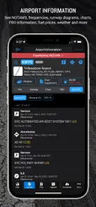
Garmin Pilot screenshot #1 for iPhone
Garmin Pilot screenshot #2 for iPhone
Garmin Pilot screenshot #3 for iPhone
Garmin Pilot screenshot #4 for iPhone
Garmin Pilot screenshot #5 for iPhone
Garmin Pilot screenshot #6 for iPhone
Garmin Pilot screenshot #7 for iPhone
Garmin Pilot screenshot #8 for iPhone
iphone
ipad

Alternatives to Garmin Pilot

Charts
Top Grossing

📈 40+7

Weather

This app rose +7 positions in Weather chart.

Last updated on September 28, 2024.

More Applications by Digital Cyclone

Reviews of Garmin Pilot

Leave a Review Garmin Pilot
  • Lack of support for European market

    Finally changed over to Foreflight. Very disappointing customer support for European operators from Garmin and the tardy updates of national charting is woefully inadequate. The system has become laggy and after being left with laggy carts and delays being to access IFR charts enough was enough. We operate Morden (new) iPads so it is clearly a Garmin Pilot system conflict. Foreflight operates quickly and smoothly and has great customer support. Very disappointing as we have used Pilot from aircraft delivery.
    Show less
  • Great App from Start to Finish

    I’ve been using Garmin Pilot for the last 4 years and 400 flight hours. I used it during instrument training and every time I fly now. It’s become my constant companion on every flight and integrates seamlessly with my G1000 avionics and Garmin Aviation watch. I’ve never used any competitors but don’t feel I need to either.
    Show less
  • Lost Canada Region for Weather Imagery

    In March the Canada Region under Weather Imagery disappeared which means Canadian Pilots can no longer access Graphical chats for weather and icing etc. This means we have to access the NavCanada data separately which is very inconvenient. Customer support advised me on April 1st they were trying to re-establish the link with NavCanada but nothing has happened.

    We can now file IFR and VFR plans in Canada using the Garmin Leidos function however it is proving unreliable as many times ATC does not receive the file and it has to be confirmed verbally.
    Show less