Free

GPS Receiver HD
⭐️5 / 5
Rating
🙌3
Ratings
📼1 vid & 4 scs
Content
📦w/o updates
Updates frequency
🗣❌ unsupported
Your locale
🧾$3.99
In-App Purchase
- Versions
- In-App Purchases History1
- Price History
- Description
- FAQ
All Versions of GPS Receiver HD
5.2.1
October 25, 2018
- small bugfixes (kml file export)
5.2
April 5, 2018
- bugfixes and improved iOS 11 support
5.1
December 15, 2017
Basic iOS 11 support.
5.0.2
September 8, 2016
- bugfix : on the previous version you sometimes could not reach the bottom waypoint lists, fixed
More5.0.1
August 30, 2016
*** REQUIRES iCloud ***
- sometimes an updated account was not able to save new waypoints properly - fixed
- occasional crash on the map - fixed
- made the wording on the upgrade (to remove adverts) more explicit
- made the iCloud requirement more clear and explicit
More5.0
August 20, 2016
*** REQUIRES *** iCloud
- upgraded to use iCloud drive
- export/import and multiple waypoint lists now available to all customers
- export uses the same settings as everywhere else (UTM,DMS,DDM,imperial)
- huge amounts of bugs fixed!
- iOS 8/9/10 compatibility
More4.1
December 29, 2014
iCloud bugfixes, professional version archives waypoint files instead of deleting them
More4.0
July 16, 2014
release notes:
-iOS7 style update
-satellite view on both platforms
-more frequent saves
-bugfixes
new features for professional users only:
-automatic iCloud syncing of all waypoint lists between your devices
-import/export into other apps in csv and kml format
More3.4
May 8, 2013
iPad : no changes
iPhone : modified the type of keyboard on editing latitude to allow decimal.
More3.3
April 4, 2013
-improved voiceover accessibility (iPhone only)
-slightly more aggressive location seeking on first start up
MoreGPS Receiver HD In-App Purchases History
$3.99
GPS Pro Upgrade
Remove ad banners, get premium support priority, help Petosoft and say thanks to me!
MorePrice History of GPS Receiver HD
Description of GPS Receiver HD
*** REQUIRES *** iCloud
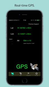
See your GPS coordinates anywhere in the world. Simple, clean interface that has received a lot of excellent customer feedback. Allows you to record and name waypoints as you go, wherever you are.
Multiple waypoint lists, import/export to other apps as csv/kml and automatic iCloud sync.
I wrote this app to be simple and effective. If you have an iPad or iPhone and want to know your latitude/longitude, please do give it a try and I hope you like it!
(On wifi only iPad models location is not very accurate and requires wifi access point connection to work, please bear that in mind.)
Show less
GPS Receiver HD: FAQ
Yes, GPS Receiver HD supports iPad devices.
The GPS Receiver HD app was developed by Petosoft Limited.
The app needs iOS 9.0 or later to function properly.
The GPS Receiver HD app has a user rating of 5.0.
The App Genre Of Gps Receiver Hd Is Utilities.
5.2.1 is the current version of GPS Receiver HD.
The latest GPS Receiver HD update came out on July 8, 2024.
GPS Receiver HD launched on February 6, 2023.
The GPS Receiver HD app is suitable for children aged Petosoft Limited.
The GPS Receiver HD app is now available in English.
Sorry, GPS Receiver HD is not available on Apple Arcade.
Absolutely! In-app purchases are accessible within GPS Receiver HD.
Unfortunately, GPS Receiver HD is not optimized for use with Apple Vision Pro.


