$5.99 Free
In-App PurchasesWith Ads
Discover Price History
↓About TwoNav
- Released
- Updated
- iOS Version
- Age Rating
- Size
- Devices
- Languages
Features
Developer of TwoNav
TURN YOUR SMARTPHONE INTO A POWERFUL NAVIGATION SYSTEM
Explore your environment with the best maps, travel the most spectacular routes, improve your performance and, above all, practice your outdoor activities in complete safety. Take your outings to a new level.
_______________________
ADAPT THE APP TO YOUR SPORT
TwoNav can be adapted to different sports, such as hiking, cycling, motor sports, flying, water sports... Create your profile and the app will adapts its configuration to this sport. Do you practice other sports? Create different profiles.
_______________________
SAFE EXPLORATION
Follow your route and keep under control the distance, time and ascent to reach your goal. Explore routes created by you, downloaded or calculate your route automatically. The App will notify if you deviate from tour course or if you run into something unforeseen.
_______________________
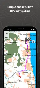
SIMPLE AND INTUITIVE GPS NAVIGATION
Forget the old roadbooks on paper. Your roadbook is now digital, everything you need to know is on the screen of your smartphone. The Aapp tells you turn by turn which road to follow.
_______________________
TRAINING TOOLS
You decide whether you train by time, by distance... or compete against yourself with TrackAttack™. Improve your performance from a previous training session. The app tells you whether you exceed your previous performance or whether you need to improve.
_______________________
CREATE YOUR OWN ROUTES AND WAYPOINTS
Create routes and waypoints by pressing directly on the screen, organize them in folders and collections. You can also enrich your references by adding photos and videos.
_______________________
OPTIMIZE YOUR PERFORMANCE
Monitor the most relevant data of your activity such as distances, speed, times and altitudes. The App will show data for what you have covered so far and what is still ahead of you.
_______________________
VISIBLE AND AUDIBLE ALARMS
Set how far you want to go, set alarms, the app will warn you if you exceed the limits you have set (heart rate, speed, altitude, route deviation...).
BROADCAST YOUR LOCATION LIVE
With Amigos™ you will be able to share your location live wherever you are. This ensures your safety and that of your loved ones.
_______________________
DETAILED ANALYSIS OF YOUR ROUTES
Back at home, analyze your routes with detail and accuracy. Relive every stage of your adventure with graphs, laps, +120 data fields...
CONNECT WITH THE WORLD
Keep your activities in a safe and accessible place thanks to the GO Cloud (30 MB free). Connect to other services such as Strava, TrainingPeaks, Komoot, UtagawaVTT or OpenRunner, synchronize your activities or download your best routes.
_______________________
If the FREE version of App TwoNav is useful, imagine how powerful is the PREMIUM version...
• App with no advertisement
• Open online maps and save offline sections
• Open any compatible map
• 2D/3D view
• Open unlimited tracks
• Open unlimited waypoint files
• Customizable data fields and alarms
• Complete configuration
• Advanced map exploration tools
• Route creation
• Return to the starting point
>>>> Buy App TwoNav Premium: https://apps.apple.com/us/app/twonav-gps-premium/id346996240
_______________________
IMPORTANT
The acquisition of this App through iTunes does not allow installation on other devices different that iOS operating systems.
Show less
What's New in TwoNav
5.9.2
July 10, 2024
Solved crash cases
Reviews of TwoNav
User interface is absolutely terrible. There are no clear instructions on how to register and download maps that you’ve purchased, lots of links that go to blank screens, and trying to pull up a map….well I’ve been waiting 15 minutes and it’s still not even halfway loaded.
Alternatives to TwoNav
More Applications by CompeGPS TEAM SL
FAQ
Does TwoNav work on iPad devices?
Yes, TwoNav has support for iPad devices.
Who developed the TwoNav app?
CompeGPS TEAM SL released the TwoNav app.
What’s the minimum iOS requirement for the TwoNav app?
TwoNav minimum iOS requirement is iOS 11.0.
How does the TwoNav app rank among users?
Users have given TwoNav a so-so rating of 4 out of 5.
What’s the app category of TwoNav?
The Main Genre Of The Twonav App Is Navigation.
What is the recent version of TwoNav?
5.9.2 is the newly released version of the TwoNav app.
What date was the latest TwoNav update released?
The last update for TwoNav was on January 5, 2025.
What is the exact date the TwoNav app came out?
TwoNav was first released on February 6, 2023.
What is the age rating of TwoNav?
This app is appropriate for all ages, with no offensive or inappropriate content.
What are the languages supported by TwoNav?
TwoNav is available in English, French, German.
Does Apple Arcade offer TwoNav as part of its collection?
No, TwoNav is not featured on Apple Arcade.
Can I make in-app purchases within TwoNav?
Yes, you can make in-app purchases to unlock additional features in TwoNav.
Can I use TwoNav with Apple Vision Pro?
No, you cannot use TwoNav with Apple Vision Pro.
Does TwoNav use ad-based monetization?
Yes, TwoNav uses ad-based monetization.


