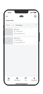
Custom Observer App
SIGN,
About Custom Observer App
- Released
- Updated
- iOS Version
- Age Rating
- Size
- Devices
- Languages
Features
Developer of Custom Observer App
What's New in Custom Observer App
1.1
November 14, 2024
The Satellite View feature in maps has been added. This enhancement allows users to view maps to a high-resolution satellite perspective.
More Applications by Aleut Community of St. Paul Island Tribal Government
FAQ
Is Custom Observer App compatible with iPad devices?
The Custom Observer App software is compatible with iPad devices.
Who developed the Custom Observer App app?
The Custom Observer App app was released by Aleut Community of St. Paul Island Tribal Government.
What is the minimum iOS version to run Custom Observer App?
Custom Observer App minimum iOS requirement is iOS 15.6.
What is the overall app rating of Custom Observer App?
There are no ratings for the Custom Observer App app at the moment.
What genre of app is Custom Observer App?
The App Category Of The Custom Observer App App Is Utilities.
Which version of the Custom Observer App app is the latest one?
The newest version of Custom Observer App is 1.1.
What date was the latest Custom Observer App update released?
Custom Observer App released its latest update on December 4, 2024.
What is the exact date the Custom Observer App app came out?
Custom Observer App was initially released on November 14, 2024.
What's the content advisory rating of the Custom Observer App app?
Aleut Community of St. Paul Island Tribal Government: The Custom Observer App app is appropriate for the age of 17 and above.
What languages is Custom Observer App available in?
Currently, the Custom Observer App app supports the following languages: English.
Does Apple Arcade support Custom Observer App among its available titles?
Unfortunately, Custom Observer App is not on Apple Arcade.
Are there opportunities for in-app purchases in Custom Observer App?
Unfortunately, Custom Observer App does not provide opportunities for in-app purchases.
Does Custom Observer App offer compatibility with Apple Vision Pro?
No, Custom Observer App does not offer compatibility with Apple Vision Pro.
Does Custom Observer App display any ads?
No, Custom Observer App does not display any ads.


