Excellent Offline Maps
I'm reviewing from the point of view of a walker who wants to store free maps for use offline on an iPhone.
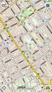
Vectorial can use the excellent OpenAndro (iOS) maps which show contours and footpaths. A huge plus is that you can download, for example, the WHOLE of Great Britain As ONE FILE with a single click and it only uses 1GB of storage. This combination of contours, detail, ease of downloading and small storage makes it at present , in my mind, unbeatable compared to the 5 other apps which I investigated for their free offline mapping capability.
EDIT: At present, you must go to the Openandromaps website in a browser, download the required map, unzip it, then tap that file to open it in VectorialMap Lite. The Tiramisu 2.0 Style (from within the app) looked best to me.
It's worth that extra effort to get contours!
EDIT 2 : The developer has produced a new version of this app which has a LOT of improvements and extra features. Its called “Cartograph”
(You can at present download Vectorial for free to test its mapping capabitities - note my first Edit - but Cartograph is the one to buy!)


