4WD Maps - Offline Topo Maps

4WD Maps - Offline Topo Maps

Offroad 4x4 GPS Navigation

⭐️2.3 / 5
Rating
🙌4
Ratings
📼5 scs
Content
📦w/o updates
Updates frequency
🗣❌ unsupported
Your locale
🧾$18.99 - $64.99
In-App Purchase
Subscribe to price changes:

All Versions of 4WD Maps

2.4.2

September 7, 2022

Updated Maps: Great Desert Tracks & Simpson Desert New Map: Nullarbor Plain Easier to tap toolbar buttons on iPhone (swipe home twice to close the app)
More

2.4.1

September 25, 2021

Compatible with iOS15 Main-screen data boxes enhanced (tap-and-hold at edge of screen) Display GPS range-rings (GPS Settings) New Odometer data item (tap-and-hold to reset, pause or rename) Access overlays list from main screen toolbar Improved many dialog layouts
More

2.4.0

March 27, 2021

New detailed maps of High Country Victoria New State map series covering all Australian States New detailed map of Landcruiser Mountain Park, QLD New Software features: Tap a track to select/edit Find Time, Speed and Altitude at any point on the track Split & Join Routes and Tracks
More

2.3.2

July 23, 2020

Extended Route Optimization limit to 500km Bug fixes

2.3.1

February 25, 2020

Many new and updated maps, including: The Red Center Flinders Ranges GDT Pilbara Simpson Desert The Kimberly QLD Top End South West WA New programmable buttons on the Nav data page Bug Fixes
More

2.2.2

April 18, 2019

New Hema Explorer maps & updated 4WD maps Much faster add-on map downloads Works with system network proxy setup Map list uses expanding tree view instead of Map Types button Layout works with iPhone X, etc Support for Barometer / Altitude A few bug fixes Topo250 provided as an optional download to reduce download time
More

2.2.0

July 26, 2017

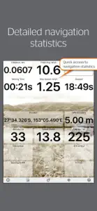
112 offline maps for touring & exploring Australia Detailed GPS navigation statistics Updated maps from Hema including Cape York, Kimberley and High Country (plus updated insets) Improved route planning Simplified map management Map scale bar Easier to customise ‘Stats’ page Ability to save data across your devices (via Memory-Map account) Optimise route feature (auto-routing online) Easier to cancel navigation mode Overlay Hide/Show setting
More

2.1.0

January 15, 2016

• 2 completely new maps added (Brisbane to Cairns, Cairns to Broome) • New edition Great Desert Tracks maps and Simpson Desert maps added • Fixed loss of map licenses after uninstall • Fixed sliders for track/route line width and opacity • Better icon selector • Compatible with iPhone 6 and iPhone 6 Plus • Share overlays using Airdrop, Google Drive and email • Other various bug fixes
More

2.0.1

May 2, 2014

- Added latest Cape York map - Added latest Northern Territory map - Minor bug fixes
More

2.0.0

April 1, 2014

• Optimised for iOS7 • 40 updated maps • 24 new maps • New instant direct map updating system • Major and minor bug fixes
More

4WD Maps In-App Purchases History

$18.99

Import 3rd Party Maps

Adds the ability to view maps published by a 3rd party

$64.99

Topo SA

Detailed topographic maps of the South Australia at 1:100,000 scale

$64.99

Victoria Topo Maps

Detailed topographic maps of Victoria

$64.99

Tasmania Topo Maps Ed2

Detailed topographic maps of Tasmania

$64.99

QLD Topo Ed2

Access detailed topo maps of Queensland

$64.99

NSW Topo maps (Ed3)

Access the detailed topo maps of New South Wa

Price History of 4WD Maps

Description of 4WD Maps

Best value Hema App. The one-time cost includes all Hema 4WD maps, without any recurring subscriptions. Use offline mapping and your device’s in-built GPS receiver to see where you are on detailed Hema maps, which feature roads, 4WD tracks, topographic information and POIs to guide your travels off the beaten track. NAVIGATE OFFLINE Find your location Real-time GPS tracking* Australia-wide map coverage Simple zooming PLOT YOUR TRIP Drop waypoints Plan routes Placename search SAVE & RECORD YOUR TRACKS Record your trips Create tracklogs Save tracks with information Share tracklogs & waypoints ACCESS HEMA'S PREMIUM MAP COLLECTION The app comes preloaded with a massive library of Hema touring and 4WD maps that covers all of Australia: Base Maps: Australia 1:250K TOPO Hema Explorer Map at 1:150,000 - 1:10M Goldfields-Esperance - Cape Arid NP Goldfields-Esperance - Cape Le Grand NP Cape York - The CREB Track Cape York - Lakefield NP Cape York - The Tip Goldfields-Esperance - Fitzgerald River NP Flinders - Flinders Ranges Mainmap Flinders - Mount Remarkable NP Flinders - Flinders Ranges NP Flinders - Vulkathunha Gammon Ranges NP Fraser Island - Central Station Fraser Island - Mid Fraser Fraser Island - Rainbow Beach Great Desert Tracks - North Central Great Desert Tracks - North East Great Desert Tracks - North West Great Desert Tracks - South Central Great Desert Tracks - South East Great Desert Tracks - South West Goldfields-Esperance and Southern Coast of WA Goldfields-Esperance Region High Country Victoria East High Country Victoria West Top End - Kakadu National Park Outback NSW - Kinchega NP Sth West Corner - Margaret River Wine Region Mid West Western Australia Mid West WA - Francois Peron NP Mid West WA - Kalbarri NP Mid West WA - Kennedy Range NP Mid West WA - Mount Augustus NP Outback NSW - Mungo NP Outback NSW - Mutawintji NP Outback New South Wales Outback Queensland Outback QLD - Bladensburg NP Outback QLD - Carnarvon Gorge Outback QLD - Currawinya NP Outback QLD - Diamantina NP Outback QLD - Idalia NP Outback QLD - Mt Moffat Outback QLD - Salvator Rosa and Ka Ka Mundi Pilbara Pilbara - Cape Range NP Pilbara - Karijini NP Pilbara - Millstream Chichester NP Pilbara - Rudall River Karlamilyi NP Simpson Desert 1:1,100,000 Simpson Desert 1:500,00 South West Corner - 200k South West Western Australia Goldfields-Esperance - Stirling Ranges NP Goldfields-Esperance - Stokes NP Outback NSW - Sturt NP The Kimberley The Kimberley - Dampier Peninsula The Kimberley - Purnululu NP The Kimberley - Wyndham-Kununurra The Red Centre Top End and Gulf - Boodjamulla NP Top End and Gulf - Darwin Region Top End and Gulf - Gregory NP Top End and Gulf - Keep River NP Top End and Gulf - Nhulunbuy DOWNLOAD ADDITIONAL MAP SOURCES Access a wide range of additional map sources which are available for purchase via the Memory-Map Digital Map Shop. USE ON WINDOWS PC or MAC Use the same maps and overlays on your desktop/laptop to plan your route and review tracklogs. (Maps sold separately). *You do not need a SIM Card installed or cellular coverage to utilise the GPS tracking functions on iPad for the app, though a WiFi+Cellular iPad is necessary to discover and track your location. A WiFi-only iPad does not contain the in-built GPS that a WiFi+Cellular iPad does, however external Bluetooth GPS receivers can be purchased for use with a WiFi-only iPad.
Show less

4WD Maps: FAQ

Is 4WD Maps compatible with the iPad?

Yes, 4WD Maps works on iPads.
The 4WD Maps app was built by Hema Maps Pty Ltd.
Your iOS device should have iOS 11.4 or later installed to run the app.
With an overall rating of 2.3 out of 5, 4WD Maps has some room for improvement but is not terrible.
The 4wd Maps App Relates To The Navigation Genre.
2.4.2 is the most recent version of the 4WD Maps app.
June 29, 2024 is the date of the latest 4WD Maps update.
4WD Maps was introduced to the market on February 6, 2023.
Contains nothing objectionable, appropriate for all ages.
4WD Maps can be used in English.
No, 4WD Maps is not featured on Apple Arcade.
Yes, you can make in-app purchases to unlock additional features in 4WD Maps.
Sorry, 4WD Maps is not specifically engineered for compatibility with Apple Vision Pro.

Screenshots of 4WD Maps

iphone
ipad

More Applications by Hema Maps Pty Ltd

Alternatives to 4WD Maps

Reviews of 4WD Maps

  • Great app!

    If you are planning on touring in a four wheel drive around Australia this is the app for you.

    5 star if it was cheaper.
  • do not purchase topo maps

    I do a lot of four-wheel driving and solely rely on digital maps. I use three different iPads and have every maps software available like Hema and memory Map (which are the same) + Mud map which is different.

    I recently purchased the Hema topo maps for New South Wales which in itself is an adventure as the in app purchase does not work and you need to go to the memory maps website to purchase the license.

    However you actually do not purchase the full New South Wales topo maps which you can download and install on your device but rather you need to be connected to their maps server to download tiles of it.

    This is completely ridiculous especially if you criss-crossing New South Wales as you can actually not have the whole map with you but need to constantly rely on a working Internet connection to download the next tile.

    Obviously topo maps would mainly be used in the Bush where you actually usually do not have the Internet connection not to mention a high volume data plan
    to quickly download many megabytes.

    The general Hema maps are pretty good but displayed little additional information for example locked gates in the national parks, many smaller trails are not named, and while most of the campgrounds are displayed they are not named.

    Another little shortcoming is the very few options of waypoint icons would love to see a tent, house, car etc.
  • iPhone Usage

    So far I have found that the app is not very intuitive. You WILL need to read the support page to figure it out.

    1. I love the fact that there is now an iPhone/iPad application that contains all the maps at a reasonable price
    2. If you have been using mud map or memory map, don't bother. It's the same app with the maps.
    3. I will continue to use my normal offroad GPS for some time while using this, but I do already find my self eagerly awaiting OziExplorer app that they are in the process of developing for the additional features I would expect from it. Maybe the future updates on this will include some of them.

    Hopefully overtime and updates I will grow to enjoy this much more. Makes me want to go ahead and buy an iPad with GPS instead of just Wifi just to see how much better it would be with the larger screen usage.