Topo GPS - Topographic maps

Topo GPS - Topographic maps

Plan and follow gpx routes

Details about Topo GPS

  • Released
  • Updated
  • iOS Version
  • Age Rating
  • Size
  • Devices
  • Languages

Features

Developer of Topo GPS

🙌347
Ratings
🗣❌ unsupported
Your locale
🖼️Download
Icons↘︎

Version History of Topo GPS

10.0.2

September 20, 2024

This update solves a problem with the topographic map of Switzerland at scale 1:50,000.

10.0.1

September 17, 2024

This update solves a problem in the Watch OS app on Watch OS 10.

10.0.0

September 15, 2024

This update is optimized for iOS 18. If you have installed iOS 18, you can now add the most important functions of Topo GPS to your iOS control center and the action button. For example, you could add a toggle that you can use to record your route. And buttons that you can use to save or share your current location. If you have enabled Siri you can now give voice commands to Topo GPS. For example you can say 'Hey Siri, record a route with Topo GPS' to start a route recording. Or say 'Hey Siri, save my location with Topo GPS' to save your current location. Or say 'Hey Siri, share my location using Topo GPS' to share your current location with others. You can now also use commands of Topo GPS in the Shortcuts app.

More

9.9.1

September 3, 2024

Small improvements and corrections

9.9.0

August 22, 2024

- Creation and editing of waypoints belonging to a route is now much easier (Route details > Edit > Edit waypoints). This allows you to create routes with points. - Added coordinate systems for several countries (Italy, Malaysia, Ukraine, Greece, Latvia, Lithuania, Croatia, Bulgaria, Albania, South Korea) - Added motorcycle to route planner - Added several customisations to route planner, like preferring curved roads and avoiding tunnels. - It is now possible to extend the a route from the beginning of the route in the route planner. Tap the first route point twice to make it purple. Then add a new route point by pressing long on the map. - On the Apple Watch it is now possible to disable the warnings that can occur when you leave a route (Menu > Settings > Notifications). - Routes that are reversed in direction are now also displayed in reversed direction on the Apple Watch. - Several other small improvements and corrections.

More

9.8.2

July 4, 2024

Better keyboard support for iPad Small other improvements

9.8.1

June 25, 2024

Small improvements and corrections

9.8.0

June 18, 2024

- You can now select a part of the map by pressing and holding two fingers simulatenously on the map. If you have release your fingers, you can choose an action, for example sharing, printing and viewing the points/routes in that area. - It is now possible to print maps via Menu > Maps > Print map, or by making a selection of the map. - Aerial imagery of several regions has been added.

More

9.7.2

May 11, 2024

Corrected error loading Faroer Island maps. Small other improvements.

9.7.0

April 26, 2024

Additional maps for Switzerland, Norway and Finland Small improvements and corrections

More

Topo GPS In-App Purchases History

$0.99

64 km² of France

4 map parts of 4 x 4 km of France.

$0.99

64 km² of Great Britain

4 map parts of 4 x 4 km of your choice.

$0.99

United States - Aerial imagery

Aerial imagery of the United States

$0.99

United States topographic map

Topographic map of the United States

$2.99

Mountainbike routes layer

MTB routes from the whole world.

$2.99

256 km² of Great Britain

16 map parts of 4 x 4 km of Great Britain

$2.99

Long distance bicycle routes

Long distance bicycle routes world-wide.

$2.99

Bicycle Node Network

Bicycle node network Netherlands and Flanders

$2.99

Hiking node network

Hiking node network Netherlands and Flanders

$3.99

Topographic map of Germany

Essential for exploring Germany.

$3.99

OpenStreetMap world coverage

Ideal map for exploring cities.

$3.99

Topographic map of Spain

Essential when traveling through Spain.

$3.99

Topographic map Netherlands

Essential when visiting the Netherlands.

$3.99

Topographic map New Zealand

Indispensable for exploring New Zealand.

$3.99

Topographic map of Norway

Essential when travelling through Norway.

$3.99

Topographic map of Sweden

Indispensable for exploring Sweden.

$3.99

Switzerland topographic map

Access to entire topographic map Switzerland

Topo GPS Subscription Plans

France topographic 1 year

One year full access to the map of France.

$18.491 Year
7 Days trial

Great Britain - Topo 1 year

1 year full access to topographic maps GB.

$25.491 Year

Price History of Topo GPS

Description of Topo GPS

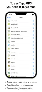
Makes from your iPhone, iPad, Apple Watch and/or Macbook a complete GPS device with detailed topographic maps. Viewed maps will be stored on your device so that Topo GPS can also be used offline. Why should you buy an expensive GPS device if you can install Topo GPS? Topo GPS contains all functions of a regular GPS device for less money, has a much more detailed map, and is more convenient to operate. The accuracy of the position determination is in favorable conditions about 5 m. Ideal for walking, hiking, cycling, mountain biking, sailing, horse-riding, geocaching, scouting, trail running and other outdoor activities. Also suited for outdoor professionals. - Map * To use Topo GPS you need to buy a map. * Official topographic maps of many countries, including Great Britain (OS Explorer), New Zealand and Australia are available as in-app purchase. * Topographic maps are very detailed maps, include height contours and are very suited for outdoor activities. * All maps of a certain region can be made offline accessible using the map download screen. * Easy switching between maps. - Routes * Recording routes, with pause and restart possibility. * Planning routes via route points. * Generating routes * Editing routes * Synchronization with your other devices via iCloud. * Searching routes with filters. * Routes can be organized into folders. - Waypoints * Easy adding by pressing long on map. * Adding waypoints through address or coordinates. * Sharing waypoints. * Editing waypoints. - Layers Layers contain information that can be added to and removed from the map. * Long distance bicycle routes * Mountainbike routes - Coordinates * Easy entering coordinates * Scanning coordinates * Supported coordinate systems: WGS84 decimal, WGS84 degree minutes (seconds), UTM, MGRS, and other country specific coordinate systems. * Coordinates grid layers - Intuitive interface * Clear menu with most important functions. * Different dashboard panels with distance, time, speed, altitude and coordinates. * Clear manual at www.topo-gps.com - Supported file formats: * gpx, kml/kmz, geojson (all also zip compressed), WFS, csv If you are recording a route, the GPS will run in the background. Continued use of GPS running in the background can dramatically decrease battery life. Rdzl, the company behind Topo GPS, does not obtain in any way the position of the user of Topo GPS. Rdzl does also not obtain the routes recorded by the user, and save the routes planned by the user, unless the route is shared with Topo GPS. We sell our product, not our user data. Privacy policy: https://www.topo-gps.com/privacy-policy Terms of use: https://www.topo-gps.com/terms-of-use
Show less

Topo GPS: FAQ

Is Topo GPS software compatible with iPad devices?

Yes, the Topo GPS app is compatible with iPads.

Who built the Topo GPS app?

The Topo GPS app was built by rdzl.

What iOS version is needed to run the Topo GPS app?

The Topo GPS app currently supports iOS 15.0 or later.

What is the current app rating?

Topo GPS has an exceptional rating of 4.5 out of 5, which is a testament to its quality.

What is the main genre of the Topo GPS app?

Navigation Is The Primary Genre Of The Topo Gps App.

What is the recent version of Topo GPS?

10.0.2 is the newly released version of the Topo GPS app.

When did the new Topo GPS update happen?

Topo GPS’s most recent update was on September 29, 2024.

When did Topo GPS first launch?

The app first launched on February 6, 2023.

What age rating is assigned to Topo GPS?

Safe for children to use, no mature themes or inappropriate content.

Which languages does Topo GPS support?

Topo GPS currently features the following languages: Czech, Danish, Dutch and 16 more.

Is Topo GPS part of the Apple Arcade gaming experience?

No, Topo GPS is not on Apple Arcade.

Is Topo GPS integrated with in-app purchases?

Yes, Topo GPS seamlessly integrates in-app purchases for users.

Is Topo GPS tailored for Apple Vision Pro compatibility?

Unfortunately, Topo GPS is not tailored for compatibility with Apple Vision Pro.

Does Topo GPS incorporate ads within the app?

No, Topo GPS does not incorporate ads within the app.

Screenshots of Topo GPS

Topo GPS - Topographic maps screenshot #1 for iPhone
Topo GPS - Topographic maps screenshot #2 for iPhone
Topo GPS - Topographic maps screenshot #3 for iPhone
Topo GPS - Topographic maps screenshot #4 for iPhone
Topo GPS - Topographic maps screenshot #5 for iPhone
Topo GPS - Topographic maps screenshot #6 for iPhone
Topo GPS - Topographic maps screenshot #7 for iPhone
Topo GPS - Topographic maps screenshot #8 for iPhone
Topo GPS - Topographic maps screenshot #9 for iPhone
Topo GPS - Topographic maps screenshot #10 for iPhone
iphone
ipad
watch

Alternatives to Topo GPS

Reviews of Topo GPS

Leave a Review Topo GPS
  • It works.

    The app is fine. It works well enough and I appreciate the low cost, one-time purchase pricing on maps. Subscription apps are trash.

    The issue I have is the lack of trail maps/layers. The only option I can find is “mountainbike trails” which doesn’t seem to populate the hiking trails I’m looking for when backpacking. It’s especially odd since I can manually set waypoints and create a route that seems to follow the trails that are there, but the trails themselves are not visible. Very strange.
    Show less
  • Navoigation of map is horrible.

    MacOS version is very hard to navigate map.
    This app cannot navigate map by mouse control.
    only two feature mapped to mouse control which is double click to zoomin and mouse wheel to move North and South of map.
    There is no manual for MacOS(Desktop version) of this app.
    You can navigate map with cursor key but when UI focus is not in the map cursor key won't work.
    Most of it seems to be good but very painful to plan my route or scout where we hike.
    Show less

    Developer Response

    - You can drag the map by pressing the mouse-button and moving around. - To navigate with cursors, it is important that the map has focus. Please press 'tab' to change the focus of the map. - You can zoom with the mouse, by holding the shift key, holding the mouse button pressed and moving up and down.
  • Great for an old orienteerer without a compass

    I used to compete in orienteering races. This is like an orienteering map, but easier because it shows where you are.