Topo Maps+

Topo Maps+

Offline Topographic Maps & GPS

Details about Topo Maps+

  • Released
  • Updated
  • iOS Version
  • Age Rating
  • Size
  • Devices
  • Languages

Features

Developer of Topo Maps+

🙌8.5K
Ratings
🗣❌ unsupported
Your locale
🖼️Download
Icons↘︎

Version History of Topo Maps+

8.4.1

September 11, 2024

Fixed a bug where photo icons would show up instead of a crosshair icon.

8.4

September 10, 2024

Support for iOS 18

8.3.1

September 5, 2024

A few small changes

8.3

September 3, 2024

- New: Select multiple items on the map and bulk edit them. - New: Data customization while importing KML and GPX files. - A few bug fixes.

More

8.2.1

August 12, 2024

- Added pin to location to the new measure distance tool. - A few bug fixes.

8.2

August 5, 2024

- New distance measuring tool. - Added support for nautical miles. - Fixed a few crashes.

More

8.1.2

July 29, 2024

- New “Add Region Settings”. - Added more options to the Add Route Settings. - Added a new Map Size option to the advanced map card. - Added location arrow options. - Fixed the map changing when tapping on a route. - Fixed mark my location shortcut sometimes not finishing. - Added show crosshairs option to set map center shortcut. - Change guide me on the Apple Watch to not dismiss the crosshairs. - Fixed a few crashes.

More

8.1.1

June 25, 2024

- Add new route settings. - Add new track settings. - Added a setting to turn off live activity for recording tracks. - Added the start time to track stats. - Fixed a few crashes. - Fixed an issue with app shortcuts. - Fix for the compass when using the magnetic north setting.

More

8.1

June 18, 2024

- Live activity for recording tracks. - You can now add a compass over the top of the map. - Settings for how waypoints are added. - New add waypoint shortcuts. - Fixed a few crashes.

More

8.0.7

May 29, 2024

- Added a setting for the default color for new routes and tracks. - Added a get directions to a trailhead to the route & trail details. - Fixed an issue with syncing data to the Apple Watch app. - Fixed the 2nd track recording metric in the Apple Watch app going under the first metric. - Fixed a performance issue with editing lots of waypoints at once. - Fixed maps showing up blurry in CarPlay. - Fixed the location button size getting too big. - Added the ability to remove a photo from a waypoint. - Fixed the pause button not working sometimes. - Fixed grid overlays not printing to a pdf map. - Fix for selecting waypoints in the expanded elevation profile. - Fixed a few crashes.

More

Topo Maps+ In-App Purchases History

$11.99

3 Month Map Pass

Offline hiking & outdoor trail maps. 3 Months

$14.99

6 Month Map Pass

Download & keep high resolution maps.

$19.99

12 Month Map Pass

Offline hiking & outdoor trail maps 12 Months

$29.99

3 Months PRO

Advanced tools for serious hikers. 3 Months

$59.99

12 Months PRO

Advanced tools for serious hikers. 12 Months

Topo Maps+ Subscription Plans

Topo Maps+ Essentials 3 Months

Offline hiking & outdoor trail maps

$14.993 Months

Topo Maps+ Pro: 3 Months

Go Deeper into the Backcountry

$24.993 Months

Topo Maps+ Essentials

Offline hiking & outdoor trail maps

$24.991 Year

Topo Maps+ Pro

Go Deeper into the Backcountry

$49.991 Year
7 Days trial

Topo Maps+ Elite

Maps & Tools for Backcountry Hunters

$69.991 Year
7 Days trial

Price History of Topo Maps+

Description of Topo Maps+

Designed and tested on real dirt, Topo Maps+ is packed with the maps & tools to plan and execute your backcountry adventure. ‣‣ MAPS FOR EVERY ACTIVITY ‣Setup your map based on your planned activity ‣‣ PLANNING TOOLS ‣ Compare and Download maps for use offline. ‣ Combine overlays to customize your map view ‣ Smart route-building tools ‣ Waypoints ‣ Print, email or share custom maps and routes ‣ Public, Private, and Hunting land boundaries ‣ Parcel Information ‣ Create teams and live-share members’ last known location ‣‣ ON-TRAIL TOOLS (Offline) ‣ View your current location ‣ All Maps and Overlays are downloadable ‣ Record your tracks - see where you’ve been ‣ Photo Waypoints - snap a pic and instantly shows on the map ‣ Progress on Trail - how much further on the trail ‣ Guide Me - to a waypoint ‣ Proximity Alerts - notify me when I’m close to a waypoint, trail, or region ‣ Line of Sight - what am I looking at? ‣ Downloaded elevation data for route-creation on the trail ‣‣ APPLE WATCH ‣ Integration with Apple HealthKit ‣Download maps directly to the watch ‣ Pan and zoom the map just like on the phone ‣ Drop a waypoint ‣ Record a track and see all of your stats ‣‣ CARPLAY ‣ Navigate to the trailhead ‣ Turn by Turn directions on USFS Roads ‣‣ NAVIGATIONAL MINDSET - helpful tips and tricks for keeping you safe in the backcountry! ‣‣ SUBSCRIPTION LEVELS: FREE level: view low resolution maps, record your tracks, and limited features Topo Maps+ Pro: high resolution maps, download maps, planning & on-trail tools, driving mode, import geospatial PDFs and TIFFS Topo Maps+ Elite: MapBox Satellite map, US public and private land overlays, parcel and ownership contact info, game management units. ‣‣ CLOUD Sync your routes, trips, subscriptions, and waypoints between all of your iOS and Mac devices. SUBSCRIPTION PAYMENT INFORMATION Topo Maps+ subscriptions will be charged to your Apple ID account at the confirmation of purchase and/or completion of free trial. Subscription automatically renews unless it is canceled at least 24 hours before the end of the free trial or current period. Your account will be charged for renewal within 24 hours prior to the end of the current period. You can manage and cancel your subscriptions by going to your account settings on the App Store after purchase. Privacy Policy: https://topomaps.co/info/privacy Terms of Service: https://topomaps.co/info/tos Continued use of GPS running in the background can dramatically decrease battery life.
Show less

Topo Maps+: FAQ

Is Topo Maps+ compatible with the iPad?

Yes, there is an iPad version available for Topo Maps+.

Who is the creator of the Topo Maps+ app?

The Topo Maps+ app was developed by Glacier Peak Studios LLC.

What is the minimum iOS version to run the Topo Maps+ app?

The minimum supported iOS version for the Topo Maps+ app is iOS 15.0.

What is the overall rating of the Topo Maps+ app?

4.8 out of 5 is the fantastic rating that Topo Maps+ has received from users.

What genre is the Topo Maps+ app?

The App Category Of Topo Maps+ Is Navigation.

What is the recent version of the Topo Maps+ app?

8.4.1 is the newly released Topo Maps+ version.

When was the latest Topo Maps+ update?

Topo Maps+ updated on September 29, 2024.

When was the Topo Maps+ app released?

The specific date when the app came out was February 6, 2023.

What content advisory rating is assigned to Topo Maps+?

No objectionable content, suitable for young children.

What are the languages supported by the Topo Maps+ app?

Currently, Topo Maps+ supports English, French, German and 4 more.

Is Topo Maps+ included in the roster of games on Apple Arcade?

No, Topo Maps+ is not on Apple Arcade.

Does Topo Maps+ support in-app purchases?

Yes, Topo Maps+ supports in-app purchases for added functionality.

Is Topo Maps+ designed for Apple Vision Pro integration?

Certainly! Topo Maps+ is designed for seamless integration with Apple Vision Pro.

Does Topo Maps+ use ad-based monetization?

Yes, Topo Maps+ uses ad-based monetization.
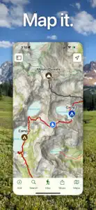
Screenshots of Topo Maps+

Topo Maps+ screenshot #1 for iPhone
Topo Maps+ screenshot #2 for iPhone
Topo Maps+ screenshot #3 for iPhone
Topo Maps+ screenshot #4 for iPhone
Topo Maps+ screenshot #5 for iPhone
Topo Maps+ screenshot #6 for iPhone
Topo Maps+ screenshot #7 for iPhone
Topo Maps+ screenshot #8 for iPhone
Topo Maps+ screenshot #9 for iPhone
Topo Maps+ screenshot #10 for iPhone
iphone
ipad
realityDevice
watch

Alternatives to Topo Maps+

Charts
Top Grossing

📉 37-1

Navigation

This app dropped -1 position in Navigation chart.

Last updated on September 29, 2024.

More Applications by Glacier Peak Studios LLC

Reviews of Topo Maps+

Leave a Review Topo Maps+
  • Excellent app for hiking in the Canadian Rockies

    I have been using this app for a number of years for all my hiking and back country adventures. It is simply the best with great support. The ability to work with Canadian Topo Maps and import our local trails is a major feature.
  • Inconvénients

    Le seul inconvénient pour moi est que toutes vos communications sont en anglais .
  • App support and developer are fantastic!

    I switched over to this app as an alternative to one I didn’t feel was worth paying for anymore. Happy to report that it’s been great so far and I don’t miss the old one. I wanted to import tracks I had recorded previously and found that some had gotten split up in the process. I replied to one of many informational emails the developer sends out and received a reply within an hour! A solution was found the next day and I was notified an update would be sent out within a week. It came out the day after (so two days after I had emailed them) and Stephen (founder) was kind enough to notify me. It worked! All my tracks imported correctly.

    Customer service is 10/10. Since I’ve downloaded the app there have been several updates which to me is a good sign that the developer is always working to improve their product. Happy that I could contribute to one and hopefully it helped someone else with the same issue. Looking forward to continuing to see this app grow. It has become a valuable tool for me on all my hikes so far.
    Show less