Free

Topo Maps US
⭐️4.3 / 5
Rating
🙌174
Ratings
📼3 scs
Content
📦~ in 3 months
Updates frequency
🗣❌ unsupported
Your locale
- Versions
- Price History
- Description
- FAQ
All Versions of Topo Maps US
6.4.1
June 23, 2024
- Location indicator now stays active when scrolled off-screen
- Fixed issue with flag/trail exported file sharing when flag/trail name contains certain characters (eg. forward slash)
More6.4
September 26, 2022
- Improved map download performance in congested areas with many trails and flags
- Additional trail type included in map downloads (equestrian)
- Fix for trail length calculation when trail compression setting is on Medium or Low
- Fix for faint checkerboard pattern behind the map detail for downloads in certain areas, eg. northern Washington state
More6.3.2
June 4, 2022
- Improved readability of toolbar buttons in flag list and trail list
6.3.1
May 11, 2021
Fixed a bug that prevented trails from appearing on the map for uncommon app update scenarios.
More6.3
March 18, 2021
The elapsed time (hours/minutes) is displayed on the screen while recording a trail. The trail details screen shows the final elapsed time and average speed.
More6.2.3
November 28, 2020
Added new map source option: USGS imagery without topographical overlay.
More6.2.2
October 18, 2020
- Fixed issue with trail recording distance appearing farther than actual distance travelled.
- Trail recording continues in locations with a limited GPS signal.
More6.2
October 29, 2019
- You can import a ZIP file containing GPX files. Send ZIP files to this app with AirDrop, Email, Dropbox export, etc.
- If you are having issues importing plain GPX files in iOS 13 the new ZIP import feature provides another way.
More6.1
September 9, 2019
- Tapping on the current location indicator displays the coordinates.
- Fixed issue with exporting flags/trails with names containing non-alphanumeric characters.
More6.0.2
August 14, 2019
Fixed issue with importing GPX files containing multi-segment tracks and routes.
MorePrice History of Topo Maps US
Description of Topo Maps US
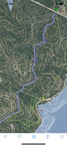
Download and view topographic maps covering the United States.
Topographic maps are useful for recreational activities such as hiking, canoeing, camping, fishing, mountain biking, geocaching, and exploring.
MAPS
Choose from 2 map sources: USGS standard topographic or USGS hybrid topographic.
OFFLINE
Download maps for areas of interest to view them later when you don't have Internet access or you don't want to use cell data.
TRACKING
Use location tracking to show where you are on the map, your elevation, and the accuracy of the GPS signal.
FLAGS
Flags are included with map downloads. Add flags (waypoints) to the map to mark your current location or other locations. Import flags from other sources using GPX files and geocache LOC files. Share flags with others using email or AirDrop. Organize your flag types by color, for example, geocaches, trailheads, and summits.
TRAILS
Trails are included with map downloads. Import trails (tracks) using GPX files you find on the Internet or from your personal GPS track collection. Share trails with others using email or AirDrop. Organize your trail types by color, for example, mountain bike trails, hiking trails, and OHV trails.
TRAIL RECORDING
Record your own trails to show where you've been on the map, follow them later, and share with others.
ELEVATION PROFILE
Recorded trails include an elevation profile (distance/elevation chart).
NAVIGATION
Navigate to a flag by following the direction arrow that uses your compass heading. Useful for geocaching.
MEASURE
Measure the distance between points on the map.
Note: Continued use of GPS running in the background can dramatically decrease battery life.
Show less
Topo Maps US: FAQ
Yes, the software for Topo Maps US is compatible with iPads.
The Topo Maps US app was created by David Crawshay.
The minimum supported iOS version for the Topo Maps US app is iOS 12.0.
With an overall rating of 4.3 out of 5, Topo Maps US is a must-have app for users.
Navigation Is The App Genre Of The Topo Maps Us App.
6.4.1 is the current version of Topo Maps US.
The Topo Maps US app was last updated on July 1, 2024.
Topo Maps US was released on February 6, 2023.
Child-friendly content, no violence or scary images.
The Topo Maps US app can be used in English.
Sorry, Topo Maps US is not available on Apple Arcade.
Sorry, in-app purchases are not accessible within Topo Maps US.
No, you cannot utilize Topo Maps US with Apple Vision Pro.


