Flytomap All in One HD Charts

Flytomap All in One HD Charts

Charts & Maps GPS Navigator

⭐️3.3 / 5
Rating
🙌4
Ratings
📼1 vid & 9 scs
Content
📦~ in 2 months
Updates frequency
🗣❌ unsupported
Your locale
🧾Free
In-App Purchase
Subscribe to price changes:

All Versions of Flytomap All in One HD Charts

6.5.10

June 21, 2024

Improved user interface.

6.5.9

June 18, 2024

Improved user interface.

6.5.8

February 17, 2023

Charts added: Albemarle Sound Apalachee Bay Bar Harbour Baton Rouge Black Bay Houma Cape Elizabeth to Cape Ann Central California Columbia River Fiji Florida South West Georges Bank Houston Juan de Fuca Strait Laguna Madre Lake Superior West Long Island South NY Massachusetts Bay Oahu-Kauai Rhode Island Sound San Juan Island Upper Chesapeake
More

6.5.7

January 23, 2023

Charts added: Caamano Sound Laredo Sound Clayoquot Barkley Sound Desolation Sound Gulfislands JervisInlet Hawkesbury Channel Kings Island Mecklenburg Vorpommern Mississippi Muritz Kolpinsee Namu Harbor Hiekish Narrows Nootka Sound Chart Northwest Vancouver Island Port Neville Blunden Harbor Queen Charlotte Strait Río de la Plata Se Sweden Sicilia Strait of Georgia Switzerland Vancouver PittLake
More

6.5.6

September 27, 2022

Charts added: Reelfoot Lake Lake Ray Roberts Tims Ford Lake North-South Lake Lake Tiorati Tunisia Oslo Puerto Rico Vancouver Approaches Saratoga Lake
More

6.5.5

July 30, 2022

Charts added: Mill Wood Lake Madeira Islands Virgin Islands Lake Whitney Waurika Lake Sauk Lake Mississippi River Pool 10 Hodstradt Lake Zurichsee Woods Reservoir Tennessee
More

6.5.4

May 25, 2022

Charts added: Gulf Islands Shetland Islands Liverpool to Glasgow Stord Lindesnes Sognefjorden to Haugesund Lake Starnberg Melilla to Arzew Tangier to Melilla Pepacton Reservoir Lake Otesgo Canadarago Lake
More

6.5.3

February 7, 2022

Charts added: Saginaw Bay Lake Shelbyville Vanern Vattern Malaren Lake Taupo New Zealand Stora Le Norris Lake Tennessee Lake Ouachita Lake Wallenpaupack Logan Martin Lake Table Rock Lake Lake Wakatipu Norfork Lake
More

6.5.2

November 16, 2021

Charts added: Walensee Zuger See, Agerisee Wagitalersee, Sihisee, Klontalersee Thuner See, Brienzersee Sempachersee, Hallwilersee, Baldeggersee Lungerer See, Sarnersee Sebago Lake Lake Pend Oreille Smith Mountain Lake Mississippi River to Galveston
More

6.5.1

October 25, 2021

Charts added: Lake Seminole Spirit Lake Lake Perris Lake Vermilion Okoboji Lake Lake Winnipesaukee Lake Sammamish Lake Maggiore Sardis Lake Wister Reservoir
More

Flytomap All in One HD Charts In-App Purchases History

Free

Maldives GPS Map Navigator

Download Maldives Nautical Charts

Free

MOB - Quick Waypoint

Man OverBoard

Free

Marine: Solent HD

Marine Cartography for Solent

Free

The Blue Hills Reservation GPS

Download Blue Hills Reservation Charts

Free

Channel Islands HD

Marine Cartography of Channel Islands

Free

Marine : Croatia HD

Download forever the charts no subscription

Free

Boating Mediterranean Sea HD

Download Mediterranean Sea HD Nautical Charts

Free

Wales and West England HD

Marine Cartography for Wales and West England

Free

Marine:UK-Ireland-Netherlands

Download forever the charts no subscription

Free

Boating USA HD Nautical Charts

Marine Cartography for USA

Price History of Flytomap All in One HD Charts

Description of Flytomap All in One HD Charts

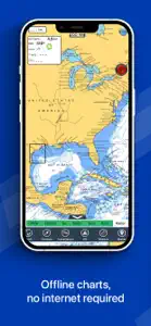
FlyToMap™ is a valid and interesting alternative, Benetti Yachts ► The charts downloaded are resident in the app. No internet connection required! Flytomap All In One HD works on all Apple devices FlyToMap™ offers a revolutionary app; you can download any chart worldwide (500+) free of charge Check out your area on viewer.flytomap.com - All USA Marine charts (US All, East, West, Great Lakes, Major Rivers, Florida, Texas, California, etc.) - USA Lake Maps 15000+ : Minnesota, Maine, Michigan, Massachusetts, Wisconsin, Texas, California, Florida, Iowa, North and South Dakota...and many more. - 150+ USA Parks and Forests - Australia Marine Charts - Australia Parks - New Zealand Marine charts - All Europe Marine Charts - 200+ major EU Parks - The world's most famous holiday destinations ie: Caribbean, Seychelles, Mauritius, Maldives, Canary Islands, Azores, Bora Bora, Bali, Oslo Fjord .. and many more. - Canada Lake Maps: Alberta, Lake of the Wood.. and many more. ► Worldwide Marine and Outdoor Maps available, thanks to viewer.flytomap.com ► Worldwide Satellite images overlay on charts ► Worldwide Terrain features overlay on charts, thanks to Open Street Map, Open Cycle Map, Bing, Earth, GMap ► Interactive Weather forecast ► NOAA raster charts seamless with continuous updates from the official Government server ► ActiveCaptain - Worldwide boaters community, with 200.000 + Captains Use to Explore: √ Latitudes and Longitudes to go to your favorite places √ Search your Favorite points directly √ Zoom, Rotate and Pan fast just by a finger touch √ Quick Object information just tapping, thanks to vector technology √ GPS Heading Vector Towards the direction movement √ Distance Measurement Tool to easily calculate the distance from one location to another √ Route planning, unlimited Waypoints - Insert the target/destination and see in real time your speed, distance and bearing √ Magnified Lens for all info √ Unlimited Tracks, Markers, Geo-tagged photos, records and share via email, visible on Google, Flytomap Viewer, KMZ format - Store your track without the need of cellular data or mobile signal √ Select Depth Contours √ a la carte menu √ iOS background mode - Flytomap works in background as well, you can swap with another app and receive/make calls send sms while track recording. √ Optimized battery usage √ And so much more to come - It’s the only app you will ever need! Our charts are installed on: NAVICO LOWRANCE B&G NORTHSTAR EAGLE SIMRAD Follow us: ▶ Twitter @flytomap ▶ Web Site flytomap.com ▶ Facebook facebook.com/flytomap FlytoMap™ has a wide range of Applications and Maps for you to use - Free of charge on Flytomap All In One ! - WATER MAPS Electronic Nautical Charts with the same accuracy and detail as on your chart plotter. Maps include Coastline, Anchoring areas, Fishing areas, Restriction areas, Obstructions, Rocks, Buoys, Beacons, Lights, Depth contours, Spot Soundings and more. - LAKE MAPS High quality lake maps with detailed information: Depth Contours, Boat Ramps, Fishing spots etc. Maps also include Trails, Roads and Railways information. - PARK MAPS: Extremely advanced electronic charts with information collected from National/State Park and Forest Services and many other local sources. The maps contain trails (Hiking, Biking, Equestrian trails etc.,) and Points of interest (POI) like Campgrounds, Visitor Centers, Lookout points, Eating places, Ranger Stations, Picnic areas, Boat/Canoe ramps, Parking areas etc.. - TRAVEL MAPS These Maps cover the most interesting touristic areas combining Sea and Land information to allow you a complete travel experience.
Show less

Flytomap All in One HD Charts: FAQ

Can Flytomap All in One HD Charts support iPad devices?

Yes, the software for Flytomap All in One HD Charts is compatible with iPads.
The Flytomap All in One HD Charts app was launched by Flytomap.
The minimum supported iOS version for the Flytomap All in One HD Charts app is iOS 12.0.
3.3 out of 5 is the fair rating that Flytomap All in One HD Charts has received from users.
Navigation Is The App Genre Of The Flytomap All In One Hd Charts App.
The newest version of Flytomap All in One HD Charts is 6.5.10.
The Flytomap All in One HD Charts app was last updated on July 1, 2024.
Flytomap All in One HD Charts was released on February 5, 2023.
Child-friendly content, no violence or scary images.
The Flytomap All in One HD Charts app can be used in American English, French (France), German (Germany) and 3 more.
Sorry, Flytomap All in One HD Charts is not available on Apple Arcade.
Absolutely! In-app purchases are accessible within Flytomap All in One HD Charts.
No, you cannot utilize Flytomap All in One HD Charts with Apple Vision Pro.

Video & Screenshots of Flytomap All in One HD Charts

iphone
ipad
watch

More Applications by Flytomap

Alternatives to Flytomap All in One HD Charts

Reviews of Flytomap All in One HD Charts

  • Free nautical charts

    This is the real plus of the app, lot of details, all charts available no subscription no inapp, no advertisements.
  • Interesting app

    Great coverage, no subscription, multiple features. I found it reliable.
  • Free nautical charts

    This is the real plus of the app, all charts available no subscription no inapp, no advertisements.