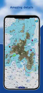
AIS Maps: Marine & Lake charts

AIS Maps: Marine & Lake charts

Detailed nautical & topo maps

Details about AIS Maps

  • Released
  • Updated
  • iOS Version
  • Age Rating
  • Size
  • Devices
  • Languages

Features

Developer of AIS Maps

🙌32
Ratings
🗣❌ unsupported
Your locale
🖼️Download
Icons↘︎

Version History of AIS Maps

6.4.3

June 12, 2024

Improved user interface.

6.4.2

June 6, 2024

Updated user interface.

6.4.1

May 3, 2024

Updated for latest devices.

6.4.0

February 8, 2024

Charts added: Georgian Bay South Hudsonriver to Raritanbay Lake Ontario West Lake Huron South Lake Erie East Lake Huron North Thousand Islands Lake Ontario East Prince William Sound South Cook Inlet Shelikof Strait East Kodiak Island East Andreanof Islands

More

6.3.19

December 20, 2023

Charts added: Behm Canal Bristol Bay Cape Ulika Cross Sound - Icy Strait Delarof Islands Dixon Entrance East Andreanof Islands Northern Cook Inlet Norton Sound Peril Strait Rat Islands Shumagin Island Sound Taku Harbor Skagway Tortuga to Margarita Island West Kodiak Island Whal Bay - Peril Strait Wrangell - Glass Penisula

More

6.3.18

February 24, 2023

Charts added: Lake Superior East Maui-Oahu Hawaii-Maui Johnston Atoll Lake Michigan North North Channel Lake Michigan South Georgian Bay Northeast Main Channel Lake Erie West

More

6.3.17

February 10, 2023

Charts added: Apalachee Bay Fiji Houston Massachusetts Bay Bar Harbour San Juan Island Central California Juan de Fuca Strait Oahu-Kauai Columbia River

More

6.3.16

January 6, 2023

Charts added: Albemarle Sound Baton Rouge Black Bay Houma Cape Elizabeth to Cape Ann Florida South West Georges Bank Laguna Madre Lake Superior West Long Island South NY Rhode Island Sound Upper Chesapeake

More

6.3.15

December 17, 2022

Charts added: Cape Fear Delaware Bay Florida North West Los Angeles Losangeles to San Diego Lower Chesapeake Matagorda Bay Mississippi River Delta Nantucket Sound New Jersey New Orleans Newhaven Sandyhook Northatlantic Canyons East Outerdelmarvapen Insula Pamlico Sound Penobscot Bay Potomac River Puget Sound North Puget Sound South San Francisco South East Cuba South Maine Tampa Florida Vermilion Bay Port Arthur York River James River

More

6.3.13

November 18, 2022

Charts added: Abaco Berry Islands Andros Island Approaches Eleuthera to Cat Islands Great Exuma to Long Island Charleston to Hilton Head Georgia Jacksonville Florida Cape Canaveral Florida Florida South East Florida Keys

More

AIS Maps In-App Purchases History

$1.99

Marine: (Oregon - Washington) HD

Marine Cartography from NOAA sources

$2.99

Lakes: Wisconsin HD

Download forever the charts no subscription

$2.99

Marine: Michigan & Superior Lakes HD

Marine Cartography from NOAA sources

$3.99

US Rivers HD

Marine Cartography from NOAA Sources.

$3.99

Marine: California HD

Marine Cartography from NOAA Sources.

$3.99

Minnesota Lakes HD GPS Charts

Download forever the charts no subscription

$4.99

Boating Texas Nautical Charts

Download forever the charts no subscription

$4.99

Marine: USA All (West, East, Great Lakes, Rivers) HD

Marine Cartography from NOAA Sources.

$4.99

Marine: US East HD

Download forever the charts no subscription

$4.99

Florida HD GPS Nautical Charts

Download forever the charts no subscription

$4.99

Louisiana Miss. Alabama HD

Download forever the charts no subscription

$5.99

Lake Powell HD Nautical Charts

Download forever the charts no subscription

$5.99

Marine&Lakes: Florida Fishing HD

Marine Cartography from NOAA sources

$5.99

Flytomap Pro HD

MOB and Multiple Overlays

$6.99

Chesapeake Bay Nautical Charts

Download forever the charts no subscription

$6.99

Marine: Georgia-South & North Carolina HD

Marine Cartography from NOAA Sources.

Price History of AIS Maps

Description of AIS Maps

Discover a new perspective on the world with AIS Maps: Marine and Lakes Charts by FlyToMap. Our app is meticulously crafted, offering a seamless blend of aesthetic appeal and functionality. Witness the world in intricate detail, thanks to vector-based map elements that maintain their crispness even when zoomed in, and experience smooth panning, tilting, and rotating for a consistently immersive view. Unlock the full potential of FlyToMap with our in-app purchase business model, providing access to a comprehensive array of maps, including Marine, Travel, Parks, and Lakes. All these maps are available for offline use at reasonable costs. Key Features: Live AIS Experience real-time map views of your boat and nearby vessels worldwide without the need for an AIS receiver—just your mobile device. Various icons denote different vessel categories, and selecting a target reveals detailed information such as name, MMSI, IMO, call sign, status, speed, heading, coordinates, distance from your GPS location, and more. Free Features and Functions: • Latitudes and Longitudes for easy navigation • Direct search for your favorite points • Intuitive zoom, rotate, and pan with a touch • Quick object information with vector technology • GPS heading for precise navigation • Distance measurement tool for easy calculations • Route planning with real-time speed, distance, and bearing updates • Magnifying lens for detailed information • Unlimited tracks, markers, geo-tagged photos, and records • Shareable via email and visible on Google, Flytomap Viewer, and KMZ format • Depth contours selection • Background functionality for multitasking • Optimized battery usage • Local marine weather forecasts at your fingertips Marine Maps: Explore detailed Electronic Nautical Charts (ENC) with information on coastline, anchoring areas, fishing spots, restricted areas, obstructions, rocks, buoys, beacons, lights, depth contours, spot soundings, and more. Lake Maps: Access high-quality lake maps featuring depth contours, boat ramps, fishing spots, trails, roads, and railways information. Park Maps: Discover advanced electronic charts with hiking, biking, and equestrian trails, as well as points of interest like campgrounds, visitor centers, lookout points, eateries, ranger stations, picnic areas, boat/canoe ramps, and parking areas. Travel Maps: Explore the most captivating tourist areas, combining sea and land information for a comprehensive travel experience. Stay connected with us: • Twitter: @flytomap • Web: flytomap.com • Facebook: facebook.com/flytomap Embark on a journey of exploration and navigation like never before with AIS Maps: Marine and Lakes Charts by FlyToMap.
Show less

AIS Maps: FAQ

Is AIS Maps optimized for iPad devices?

AIS Maps is available on iPad devices.

Who created the AIS Maps app?

Flytomap is the creator of the AIS Maps app.

What is the lowest iOS version that AIS Maps can run on?

The minimum iOS version for the AIS Maps app is 12.0.

How does the app rank among users?

3.7: The AIS Maps app receives average reviews and ratings.

What app category is AIS Maps?

Navigation Is The App Genre Of The Ais Maps App.

What’s the latest version of the AIS Maps app?

The latest version of AIS Maps is 6.4.3.

What is the latest AIS Maps update release date?

The latest AIS Maps update came out on September 29, 2024.

What is the exact date when AIS Maps came out?

AIS Maps was first released on February 5, 2023.

What’s the age rating for the AIS Maps app?

Flytomap: Contains no objectionable material.

What are the languages offered by AIS Maps?

The AIS Maps app can be used in American English, French (France), German (Germany) and 3 more.

Can I find AIS Maps within Apple Arcade's selection of games?

Sorry, AIS Maps is not available on Apple Arcade.

Are in-app purchases available within AIS Maps?

Absolutely! In-app purchases are accessible within AIS Maps.

Can I utilize AIS Maps with Apple Vision Pro?

No, you cannot utilize AIS Maps with Apple Vision Pro.

Can I expect ads while using AIS Maps?

No, you can not expect ads while using AIS Maps.

Video & Screenshots of AIS Maps

AIS Maps: Marine & Lake charts video #1 for iPhone
AIS Maps: Marine & Lake charts screenshot #2 for iPhone
AIS Maps: Marine & Lake charts screenshot #3 for iPhone
AIS Maps: Marine & Lake charts screenshot #4 for iPhone
AIS Maps: Marine & Lake charts screenshot #5 for iPhone
AIS Maps: Marine & Lake charts screenshot #6 for iPhone
AIS Maps: Marine & Lake charts screenshot #7 for iPhone
AIS Maps: Marine & Lake charts screenshot #8 for iPhone
AIS Maps: Marine & Lake charts screenshot #9 for iPhone
AIS Maps: Marine & Lake charts screenshot #10 for iPhone
iphone
ipad
watch

Alternatives to AIS Maps

More Applications by Flytomap

Reviews of AIS Maps

Leave a Review AIS Maps
  • Waste of money don’t buy

    This apps is terrible don’t waste your money.
  • Great app!

    It works well, offering all the features I need at a reasonable cost without a subscription. I particularly appreciate the weather forecast feature, which allows me to view forecasts for any location.

    Developer Response

    Hi, we are grateful that you took the time to write this post and submit it. Can you please let us know any kind of features you need to be included in our app? We appreciate any comment as we always strive to improve our products. You can contact us at our website support, www.flytomap.com we will be happy to assist you.
  • Garbage

    You pay then you get advertising for more pay in-app purchases…..Garbage!

    Developer Response

    Hello, Please contact us on our website support, www.flytomap.com . we will be happy to assist you.