The data you need to plan your fishing day. Home to the most trusted and accurate satellite and topo maps, onX Fish is a fully-functioning GPS navigation app on your phone. View private and public property land ownership data, lake access and area amenities, species information per body of water, and more on your custom maps.
Right now onX Fish is only live in Minnesota and Wisconsin, but we’re working on adding other states to the app soon. The good news is that Minnesota and Wisconsin anglers can now deep-dive into an app designed to help them make the most of their time on the water.
We all know a successful day on the water starts with a plan. You have to know what species you’re after, what kind of water they live in, and how to get there. onX Fish helps you form a game plan with information including:
- Species information per body of water
- Boat ramps and access points for lakes and rivers
- Resources to find the best public access locations
- Updated fishing regulations
- And so much more
▶ Free for a Limited Time
onX Fish is currently available in Minnesota and Wisconsin, and free for a limited time.
▶ Free Fishing App Features
- Species survey data overview
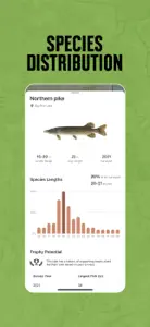
- Species distribution
- Public/Private land ownership
- Regulations, including special regulations
- Lake access points
- Weather information
- Mark, customize and share Waypoints
- Recent satellite imagery
- Shaded lake contours
▶ Find Lakes to Fish Using Fishing Spots
Plan your fishing day using curated data and tools within the onX Fish App. Find which species live in which body of water, boat ramps and access points, fishing regs, current weather conditions, and more—all in one place.
▶ Identify Your Target Water by Filtering by Species and Boat Launch Information
onX Fish makes finding boat ramps and access points easier than ever before. Find boat ramps for every body of water. Filter fisheries by species information, helping you find the best water for your target fish.
▶ Know What to Expect With Fish Species Size Distribution Survey Data
Put the odds in your favor by knowing your target species before hitting the water. In the onX Fish App you’ll be able to search by species, find what lakes and rivers they live in, how to get there, and much more.
▶ Plan Your Day Using Access and Amenities Information
Easily find waterbody access information and details on nearby amenities. Go into your day with a plan knowing how to get on the water and what to expect once you’re at the boat ramp or access trail.
▶ Build Tactics Using Tools Such as Recent Imagery, Lake Contours, Weather, and More
Dive into shaded contours to help you visualize and understand lake bottoms, so you can imagine where fish might be within the water column. Visualize conditions with Recent Imagery updated every two weeks, mark productive spots, and more, right on your computer or phone. Explore current and forecasted conditions, wind speeds, and more to help determine the best time to hit the water.
▶ Private and Public Land information Around Water Bodies
Our public and private land boundaries will help you identify public access points and avoid crossing onto private land. Ensure that you are accessing fishing legally and making the most of your public land opportunities.
▶ Terms of Use
https://www.onxmaps.com/tou
▶ Feedback
Have a problem or want to request new features? Contact us at support@onxmaps.com.
Show less


